http://www.lib.ncsu.edu/gis/doqq.html
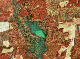
A DOQQ map, or Digital Orthophoto Quarter Quads map, is a digital aerial image produced by the USGS. The advantage of a DOQQ map is that it is a spatially accurate image that shows things in their correct geographic locations. This digital picture is an aerial color infrared photograph of Johnston County Nebraska in 1998.

No comments:
Post a Comment